Wolf River Access Points
LaGrange, TN Access Point (Ghost section input)
- PLEASE READ THIS IF YOU'VE NOT DONE THIS SECTION BEFORE!
- Google Maps Link to LaGrange Access Point
- Wolf River Gauge at LaGrange, TN
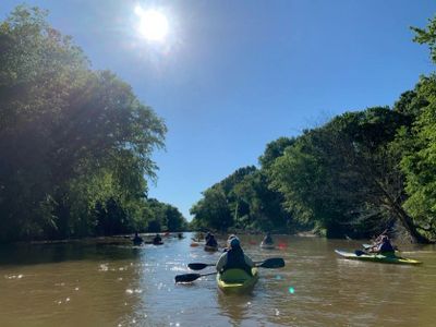
The Ghost River section of the Wolf River is considered the crown jewel of the entire Wolf River! Marked by five separate distinct eco systems a paddler might think they are on five different rivers. An inexperienced beginner should not attempt this river without the assistance of a guide due to the probability of multiple portages, the possibility of weather related conditions and illnesses, and ambiguous trail marking.
Bateman Road (Ghost section output, Lost Swamp Input)
The Lost Swamp section of the Wolf River is just as beautiful as the Ghost River section. Like the Ghost, it is recommended that beginners and inexperienced paddlers use a guide when attempting this section for the first time. Black sand along the river bed is unique to this section and has been nicknamed the "Wolf River Spa."
Moscow, TN Access Point
Rossville, TN Access Point
The section beginning at Rossville, TN is referred to as the beginning of the "middle" Wolf River. The cypress swamps the Wolf meanders through are no more and the river is defined by a channel. This is an incredible section of the Wolf that will try the skills of the most experienced paddler while being doable by beginners.
Piperton, TN Access Point
This section is a continuation of the previous section. One thing to be mindful of is the rock weir at the very end of this section that is under the Collierville-Arlington bridge.
Collierville-Arlington Road Access Point
- Google Maps Link to Collierville-Arlington Road Access Point
- Wolf River Gauge at Collierville-Arlington Road
This section is NOT recommended for beginners due to four rock weirs between Collierville-Arlington Road and Houston Levee Road.
Houston Levee Road Access Point
- Google Maps Link to Houston-Levee Road Access Point
- Wolf River Conservancy Information Page About the Houston Levee Road - Germantown Road Section
The access point at Houston Levee Road can be treacherous, but once on the water a paddler will see where the middle Wolf transitions into the lower Wolf River at Grays Creek. The river changed course at this point in 2019 and is an amazing example of the pure strength of nature.
Germantown Road Access Point (Beginning of the Urban Wolf Section)
- Etiquette for the Germantown Road Access Point
- Google Maps Link to Germantown Road Access Point/Loadling/Unloading Area
- Google Maps Link to Germantown Road Access Point PARKING AREA
- Wolf River Gauge at Germantown Road
The access point at Germantown Road might be a little intimidating to get to but it isn't too bad. Please don't leave your car at the unloading area. This is the perfect day trip for anyone! Marked by nice, slow, shallow water and numerous sandbars it is fun for a lazy float or beach picnic! The access point at Walnut Grove can be extremely muddy, so make sure everyone has a towel to wipe off with so keep the inside of the vehicles clean! Please check the Walnut Grove Road access point prior to launching from Germantown Road.
Walnut Grove Access Point
This access point can get dangerously muddy after strong storms and high water. We recommend checking this access point before getting on the river at Germantown Road.